Home  /  LAND AI

Geospatial intelligence

LAND AI

The geospatial intelligence platform that integrates satellite, geological, climate, water, agricultural, regulatory and economic data to turn the territory's heterogeneity into structured, decision-grade signal.

Data Sources

From raw heterogeneity to structured signal

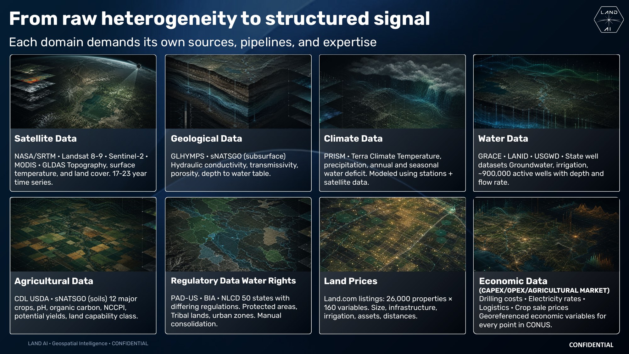
Each domain demands its own sources, pipelines and expertise. LAND AI integrates eight families of georeferenced data covering the entire conterminous United States (CONUS), harmonized onto a single spatial grid.
LAND AI — De la heterogeneidad bruta a la señal estructurada: ocho familias de datos

The eight data domains of the platform: satellite, geological, climate, water, agricultural, regulatory, land prices and economic data.

NASA/SRTM · Landsat 8-9 · Sentinel-2 · MODIS · GLDAS

Satellite data

Topography, surface temperature and land cover, with 17–23 year time series that capture the long-term dynamics of the territory.

GLHYMPS · sNATSGO

Geological data

Subsurface properties: hydraulic conductivity, transmissivity, porosity and depth to the water table.

PRISM · TerraClimate

Climate data

Temperature, precipitation and annual and seasonal water deficit, modeled from weather stations combined with satellite data.

GRACE · LANID · USGWD

Water data

Groundwater and irrigation, including state well datasets with about 900,000 active wells documented with depth and flow rate.

CDL USDA · sNATSGO

Agricultural data

Twelve major crops with soil pH, organic carbon, NCCPI index, potential yields and land capability class.

PAD-US · BIA · NLCD

Regulatory data and water rights

Fifty states with differing regulations: protected areas, indigenous lands and urban zones, manually consolidated into a single layer.

26,000 properties × 160 variables

Land prices

Market evidence per property: size, infrastructure, irrigation, assets and distances to key services.

CAPEX · OPEX · Agricultural market

Economic data

Drilling costs, electricity rates, logistics and crop sale prices — economic variables georeferenced for every point in CONUS.
Methodology

One stack. Eight disciplines.

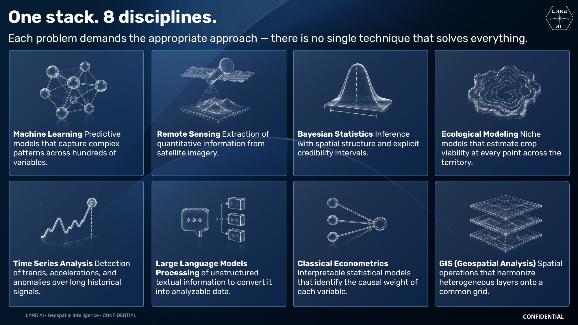
Each problem demands the appropriate approach — no single technique solves everything. The platform combines eight analytical disciplines over a common spatial grid.

LAND AI — Un solo stack, ocho disciplinas analíticas

The analytical stack: machine learning, remote sensing, Bayesian statistics, ecological modeling, time series, LLMs, econometrics and GIS.

Machine learning

Predictive models that capture complex patterns across hundreds of variables.

Remote sensing

Extraction of quantitative information from satellite imagery.

Bayesian statistics

Inference with spatial structure and explicit credibility intervals.

Ecological modeling

Niche models that estimate crop viability at every point across the territory.

Time series analysis

Detection of trends, accelerations and anomalies over long historical signals.

Large language models

Processing of unstructured textual information to convert it into analyzable data.

Classical econometrics

Interpretable statistical models that identify the causal weight of each variable.

GIS (geospatial analysis)

Spatial operations that harmonize heterogeneous layers onto a common grid.

Discover the platform

Ready to see the territory in 360°?

Visit the LAND AI website to explore the platform, its data sources and its analytical capabilities in depth.